We had quite a late start, catching up on sleep missed with the early start from yesterday. It was five to ten before we checked out of the bnb. We headed for the cable car. It runs up the hill next to the Bridle way. This was the route that early settlers took from Lyttleton Harbour over the hills and then down to Christchurch. They had to carry their household goods with them. We just had a light rucksack!
We opted to take the cable car up the hill from Christchurch to the top and walk down. It's a good view both from the car as you travel up and from the observation deck at the top. Of course it ends in a gift shop where Jono saw the same t shirt he wanted in the Antarctic centre gift shop but it wasn't in his size there. With a discounted offer for buying two t shirts he was easily persuaded!
An unexpected bonus was the time tunnel, a 7 minute ride through the history of Christchurch included in the cable car ticket.
The walk down was more challenging than we had expected. The path was of loose gravel and very steep; we held hands and took baby steps all the way down. We passed a few hardy souls on the way up and were particularly impressed with the young boy near the top who proudly told us he had done it all without being carried!
 |
| View from top observation deck over Lyttleton |
 |
| Starting the walk along the ridge |
 |
| The pioneer womens memorial |
 |
| Top of cable car is the building on top of the hill. We've walked along the ridge and are about to head on the gravel path down |
There was one other town between us and Ashburton and it was where New Zealand's longest bridge at 1 km long was situated. It's not a pretty bridge and it crosses gravel streams which are also mot particularly pretty but we can say we have travelled over it. We spotted a petrol station here at the lower price and gladly refilled. It's a bit unnerving driving with so little in the tank when there are long gaps between towns and places to refill.
We stopped again at Ashburton and had a picnic lunch in the very pretty park there and then continued on to Geraldine, now heading up towards the southern alps and away from SH1. This was a relief. The road had been very monotonous. Straight and flat with fields on either sides.
Geraldine, the guide book informed us ,had a replica 64ft bayeaux tapestry made from steel mosaic pieces made from patterning discs of industrial knitting machines. The tapestry has a mathematical pattern which no one has been able to solve yet.
Unfortunately the site where it should be displayed appeared deserted. We popped into the tiny local museum in case it had moved. Here we learnt how New Zealand flax had helped in WW2, huge amounts shipped to the UK for multiple purposes including for the covering on Spitfires. We also learnt the tapestry had gone on a 3 month tour to the UK somewhere and might be there longer. Guess we will have to try to find out where it is when we are home!!!!.
Onward towards the southern alps. We stopped again at Fairlie for a slice of cake and for Jono to have a coffee with an extra caffeine shot. Another English couple came over to look at our hire car (of all things) and we swapped more tips and travelling stories. Revived we headed on to Lake Tekapo just another 30 minutes further.
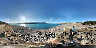
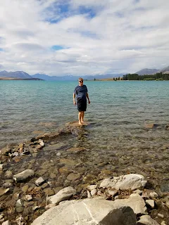
This is one of a series of lakes with beautiful blue water coming from the mountains. We wandered around the lake,crossed the pedestrian bridge, visited the little church and the collie dog memorial and watched the little black ducks(?) dive underneath.
It was 24 degrees and gone 7pm. Some people were still swimming in the water.
Link to 360 panoramahttps://photos.app.goo.gl/WzVzLC1XmIeGET0z2
 |
| Link to 360 panorama |
Our last check-in time was 8pm- we had to go on. Lake Pukaki another stunningly blue lake also dammed and use for hydro electricity was another 30 minutes westward. We stopped again to wander down by the lakeside where freedom campers were also pulled in for the night.
 |
| Lake Pukaki 360 panorama |
Great place to stay, we would happily book in here again. We ate, unpacked, booked a place to stay in Dunedin and then as the sun set we went back to Lake Pukaki. This region is a dark skies area and there is an observatory on Mount John at Tekapo. You can go up at night and star watch from there. We chose to lie down by the lake and just marvel at the sheer number of stars. Orion was very clear, an old friend from home. We easily found the Southern Cross and the Milky Way. We had to get some trees between us and the crescent moon which was annoyingly bright to really get the full impact of the stars. Very romantic and beautiful.


No comments:
Post a Comment